The Island of Mindoro was mentioned in some Chinese Chronicles as the land “Ma’I” where Ma’I residents were believed to be trading with merchants from other parts of archipelago and Southeast Asia. The Spaniards visited the island in 1570 and established a settlement in Puerto Galera. The port in Puerto Galera has become an important median for galleons proceeding to and from Mexico. Mindoro became part of Batangas until the early 17th century and became part of Marinduque in June 1902. It was proclaimed a special province in November 1902 un became a regular province through Republic Act No.2964 on February 20,1921. On June 13, 1950, by virtue of RA 505, the Mindoro province was separated into Oriental and Occidental Mindoro.
Location,Geography and Climate
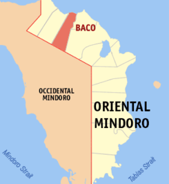
Oriental Mindoro is the eastern portion of the island which is about 140 kms southwest of Manila. It is bounded by the Verde Island Passage in the north, Marinduque, Concepcion, Romblon, and tablas strait in the east, Semirara and Antique in the South and Occidental Mindoro in the west. The province is composed of 14 municipalities and one component city. CalapanCity is the only city and the capital of Oriental Mindoro.
Climate: Oriental Mindoro’s climate favors for vegetable growth all year round. There is no pronounce wet and dry season for the province.
